Princess
| Vancouver From the Water |
Just like last year, the conference included some decompression time. And like last year, it consisted of a cruise around Vancouver's northwest peninsula, around to False Creek. The weather was great.
|
Princess |
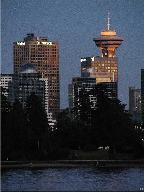
This year, however, we took the Harbour Princess, a somewhat more streamlined vessel than the paddlewheel Constitution we took last year. Get a load of the cockpit on this ship. No, it's not the row of windows on top deck... it's that wedge-shaped capsule on the deck just below it. Wild. |
| Seven o'clock, and it's time to pull out into Coal Harbour. |
Weigh anchor |
|
Rock Face |
Having just cleared the Lion's Gate Bridge, we round the point at the northern tip of Stanley park. There's a trail around the entirety of the park there at water level (and in fact, it stretches along Vancouver's shore in both directions for several miles.) |
| Yesterday's water-taxi ride began here at the piers at the western end of Hornby. Now cruising along on the excursion boat, we get to see things from slightly higher above the water. |
Landing at Hornby |
|
Houseboats |
As with nearly every protected coastal urban area, there are those that enjoy living not just on (that is, by,) the water, but literally on it. Interesting one-of-a-kind homes seem to be the norm. It should come as no surprise, then, that these are situated along Granville Island's shores. |
| Near the end of False Creek we find Science World looking as much like a silver dandilion as like a high-tech structure. |
Science World |
|
Glass House |
On our way back out of False Creek, we see the sun making steady progress toward the western horizon. Here it's seen through -- and illuminating -- one of the many glass structures along Vancouver's waterfront. |
| False Creek is bridged here by Granville Street bridge in the foreground and Burrard Street bridge beyond that. Way in the distance you see the hills and mountains beyond "West" Vancouver (which is actually to the city's north...) |
Twin Bridges |
|
Dragon Boat |
Does this boat look a little out of place? Or maybe, a little out of time? Surrounded by navigable water, Vancouver is home to many boating enthusiasts, which explains their annual Dragon Boat festival (which had concluded a few weeks before.) That event was actually started by the Chinese community, who have dragon boats as part of their tradition, but this Norse specimen can also lay claim to dragon-boat status. |
| Just making use of the camera's 10x zoom to get a picture-filling view of the boat. Hmmm... doesn't seem that there are too many woolly norsemen at the oars here. But then again, that sail seems fairly full. |
Closer to the Dragon |
|
Rosy Mt. Baker |
As more and more parts of Vancouver are bathed in the cool lavendar of twilight, Mount Baker continues to glow a dusky pink. Baker is actually about fifty miles away, in northern Washington State, just below the 49th Parallel. And if the conical shape hasn't suggested it to you, it is in fact a volcano... one of several semi-active candidate mountains that will eventually share Mount St. Helens' fate. |
| With the sun set, and the fiery color drained from much of the sky, we make our way back under the Lion's Gate bridge, here aglow in the waning light. |
Lion's Gate |
 Long View |
The desination seems to be near, but actually it's not. Extreme magnification caught the Vancouver skyline through a low part of Stanley park. There's all of Coal Harbour between the park and the skyline, and a good chunk of Burrard Inlet in the foreground. |
| This is what I mean. There's as much water beyond the park as is in front of it... |
Wider View |
|
Clearing the Point |
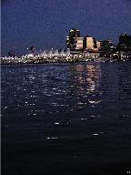
The tent-like structure of Canada Place is visible as we clear the point near the east edge of Stanley park. The skyline reflects the last of the western glow, already far more pale than it was mere seconds ago. |
| Quickening the shutter speed darkens the picture, exaggerating the color of the sunset. |
Fiddling with exposure |
 Quiet Waters |
No telling how deep these waters run, but I suspect -- owing to the glacial origin of the land -- they're not too shallow. |
| Just another try at the paling western sanguine glow. |
Day's Last Fire |
 Sudden Darkness |
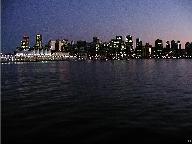
It does get dark quickly. Not too long after the western sky goes cold, the rest of the heavens will plunge into indigo night, and the waters follow with their own inky interpretation. That won't be long now. |
| It takes literally dozens of photos to get one or two that seem "just right." This one comes close. |
Twilight Skyline |
 Night Colors |
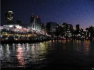
Though night now has dominion, Vancouver is not without color... |